
One of my current obsessions is looking for bench marks that are visible on historic maps of Sligo. Bench marks were established by the Board of Ordnance, later the Ordnance Survey’ to accurately map elevation above sea level. This served a very practical purpose as it coincided with the construction of drains which needed to take account of local topographic changes to prevent backflow.

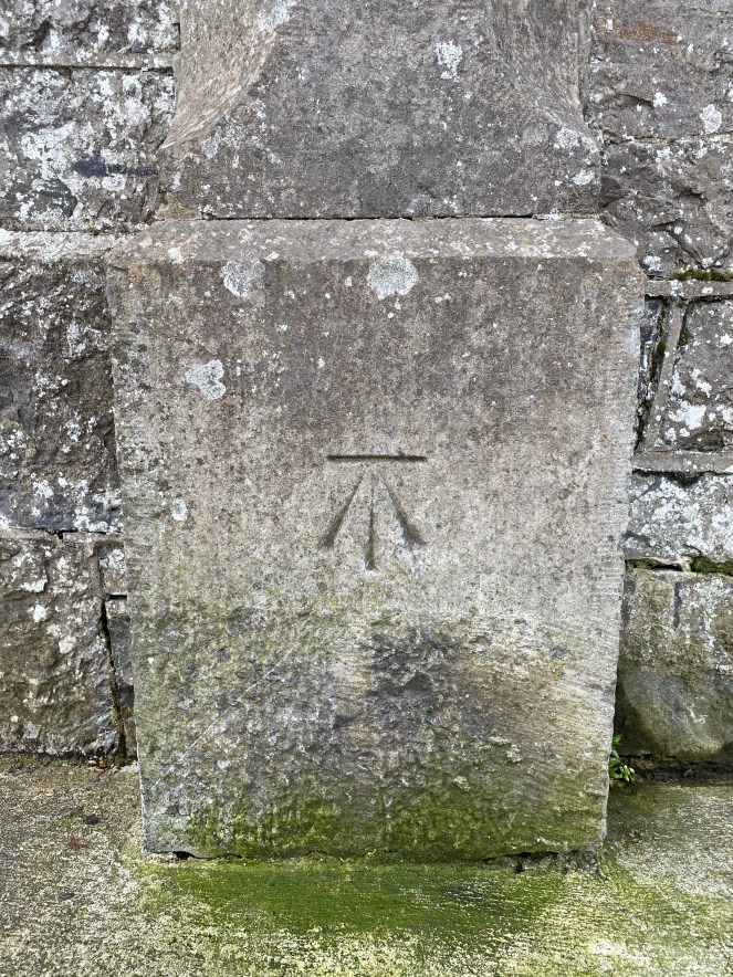
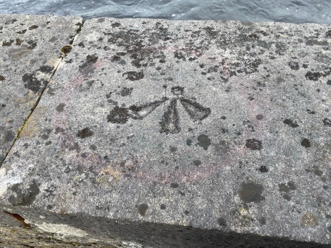
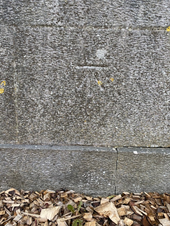
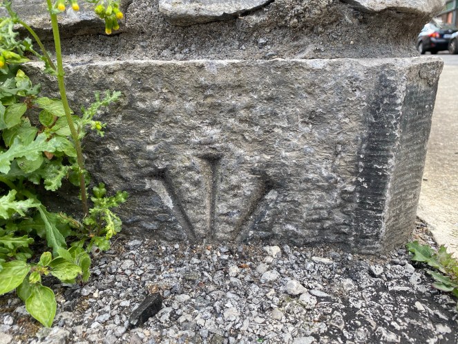
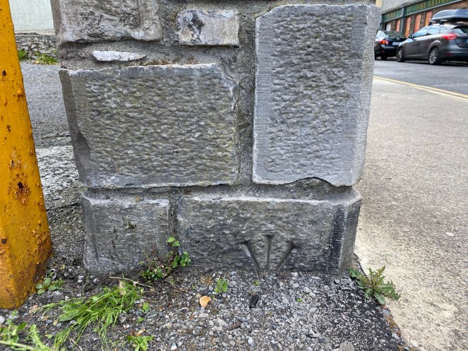
The bench mark network is no longer maintained (GPS and high-accuracy points are used instead). Many, as I have discovered, have been removed – the walls or buildings that they were engraved on to have often been replaced or destroyed. There are a number of different types of benchmarks, but most involve a cut or carving into stone and they are often easy to spot, mostly comprised of an engraved upward arrow, often pointing to a horizontal line, circular ‘pivot’ depression, or a metal (copper, iron or lead) bolt or rivet.
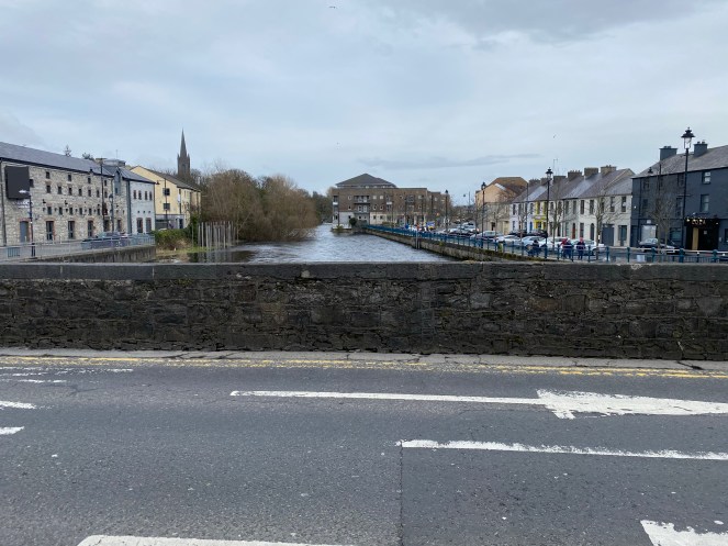
This blog post represents a series of maps and photos I’ve assembled as part of my research. I first developed an interest in the Sligo Bench marks (BMs) when I realised there were very few historic features that I could correlate a modern survey to in and around Sligo General Hospital, due to a loss of 19th century structures and boundary features. My GIS students and I worked through the problem to discover potential points of correlation. The closest reliable structure is The Model, which has a BM, about 250m from my area of interest. I subsequently began noticing BMs all over Sligo, and the absence of several of them. This is my list so far of BMs visited, with comments on their presence/absence and setting. These have also been captured in a database and records are being updated in to an evolving GIS.
Methodology
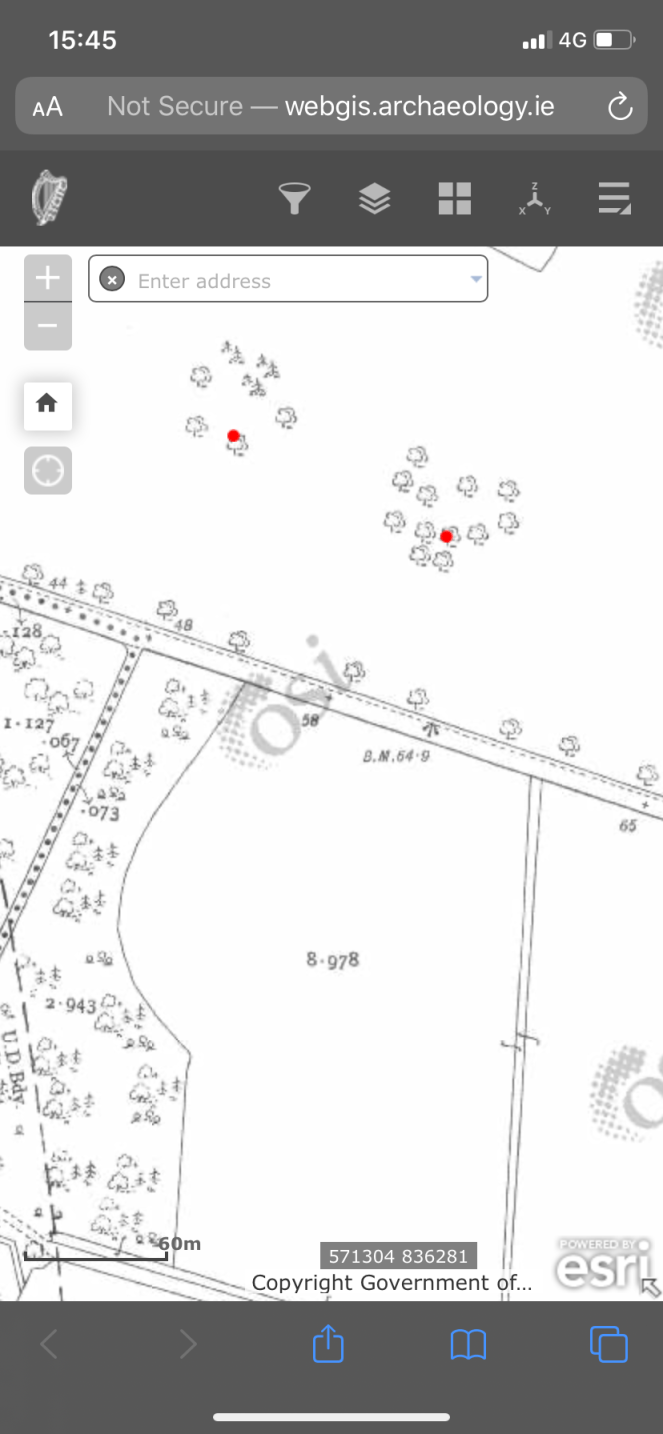
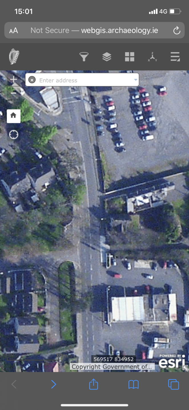
The aim is to visit the location of all Sligo town BMs and assess their survival. I’ve been using the 1875 Town map, the Historic 25 inch map (published 1912-1913 for Sligo), and the Cassini 6 inch map. These last two can be accessed via a number of online portals (I use the Historic Environment Viewer), to map BMs. The Sligo Town map is one of about 150 town maps that were created across Ireland in the 19th century at 1:500 scale (10 feet to one mile). Luckily for me, Sligo is one of those towns, captured across 23 mapsheets (see the full list of towns mapped at this scale here). I decided to set a defined geographical extent for this study, by using the U.D. (Urban District) Boundary (marked on the 1912-1913 Historic 25 inch map). The U.D. Boundary surrounds Sligo and is 4,100m in diameter; as a geographical marker, it provides an ideal context for a defined study area. My (hobbyist) wanderings meant that I already have some BMs that are located outside this range, so I’ll keep them here on this list for now, but I’ve excluded them from the GIS at present. The U.D Boundary also captures all of the 1875 Sligo Town mapsheets as well.
The BM locations were taken from each map and relocated on to a modern OS map (important to note that the ITM coordinates for the online Historic map have an error of 14-20m) using Quantum (Q) GIS (v.3.12.1-București). Some of the 1875 Town map BMs are missing from the later Historic 25 inch / Cassini maps, and/or the Historic 25 inch / Cassini maps had new additional BMs, and so the study records these changes too.
I’ve visited many of the BMs (30 January – 05 June 2020), using the maps as a guide, taking a screen grab of the location, and a series of photographs. The photographs show a close-up of the BM itself (or, if removed, where it had been), and its wider geographical setting. Notes on the condition of the BM, are logged below, and captured in a spreadsheet. The spreadsheet details are then uploaded to QGIS. BM data (facing direction, elevation, location etc) were also included within the GIS, as well as Photographs of historical maps and the BM (or its location, if removed). The GIS was used to create a Layout Map seen below.
Fieldwork ceased during the Coronavirus Lockdown in Ireland. However, the gradual unlock means that I can begin to travel a little more. Lockdown has also given me the chance to sit down and write up the field notes and develop the GIS. I have thought about using Google Streetview – in some cases it is useful – but too often the BM locations are obscured by traffic, pedestrians, street furniture, or the BM is located beyond the Streetview capacity. Besides, the project started as a way to kill time for 90 minutes whilst in Sligo, and that’s how it should continue.

Stats at a Glance
There are 48 BMs inside the Sligo U.D. Boundary, marked on the Historic 25 inch map. To date, I have visited 19 of the 48 BMs, and categorised them as follows:
Total BMs: 48
BMs Visited: 19
BMs In Situ: 7
BMs Removed: 7 (3 of which were removed by the time the Cassini map was published)
Schrödinger’s (BMs of Unknown condition): 4 (where the it is believed that the material fabric on which the BM is engraved is present, however the BM could not be seen – it could be in situ beneath fascia or thick ivy, or may have been removed).
BMs Requiring a Revisit: 1 (in light of new data)
BMs that still Require Assessment: 29
BMs occurring on Buildings registered in the National Inventory of Architectural Heritage: 8
Detailed Listing
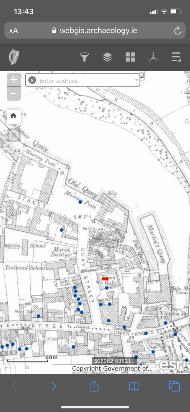
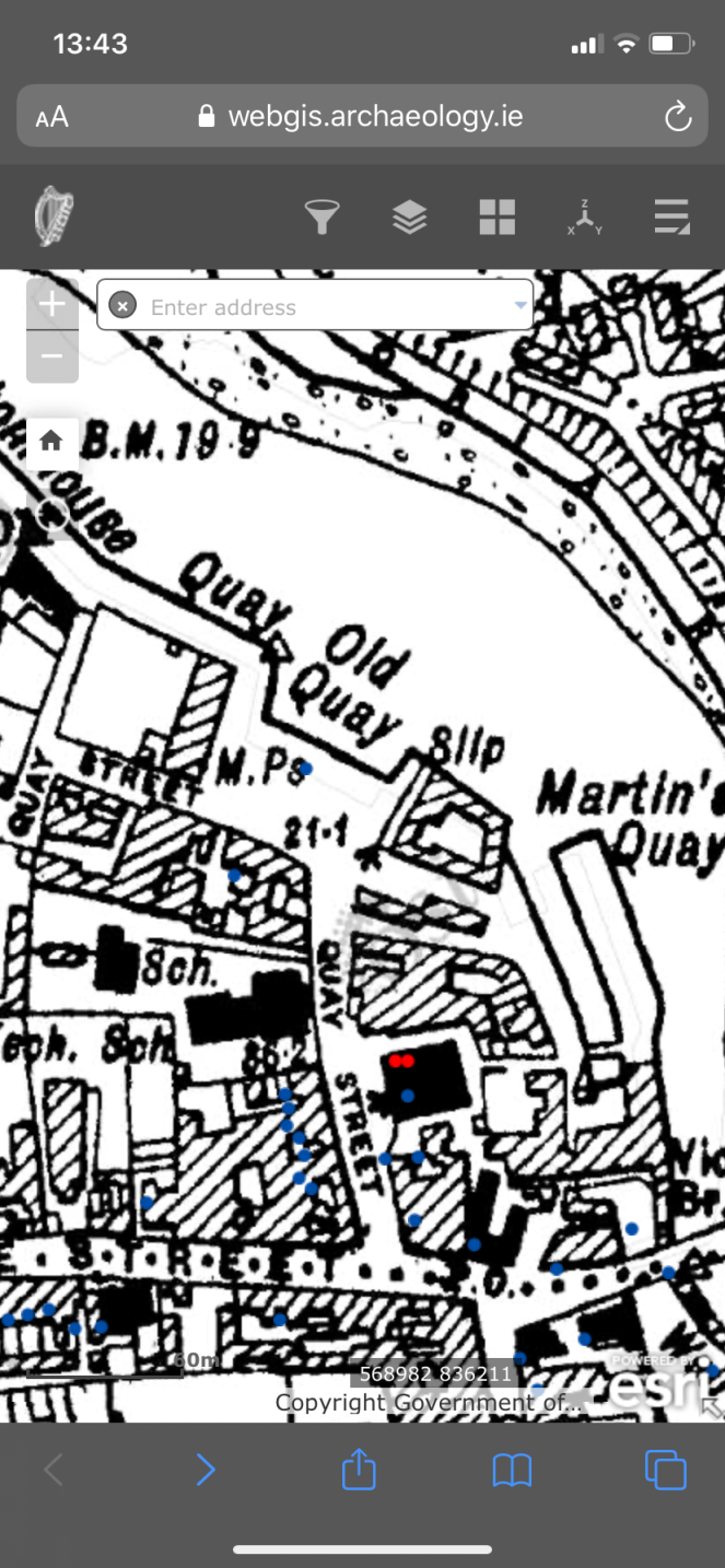
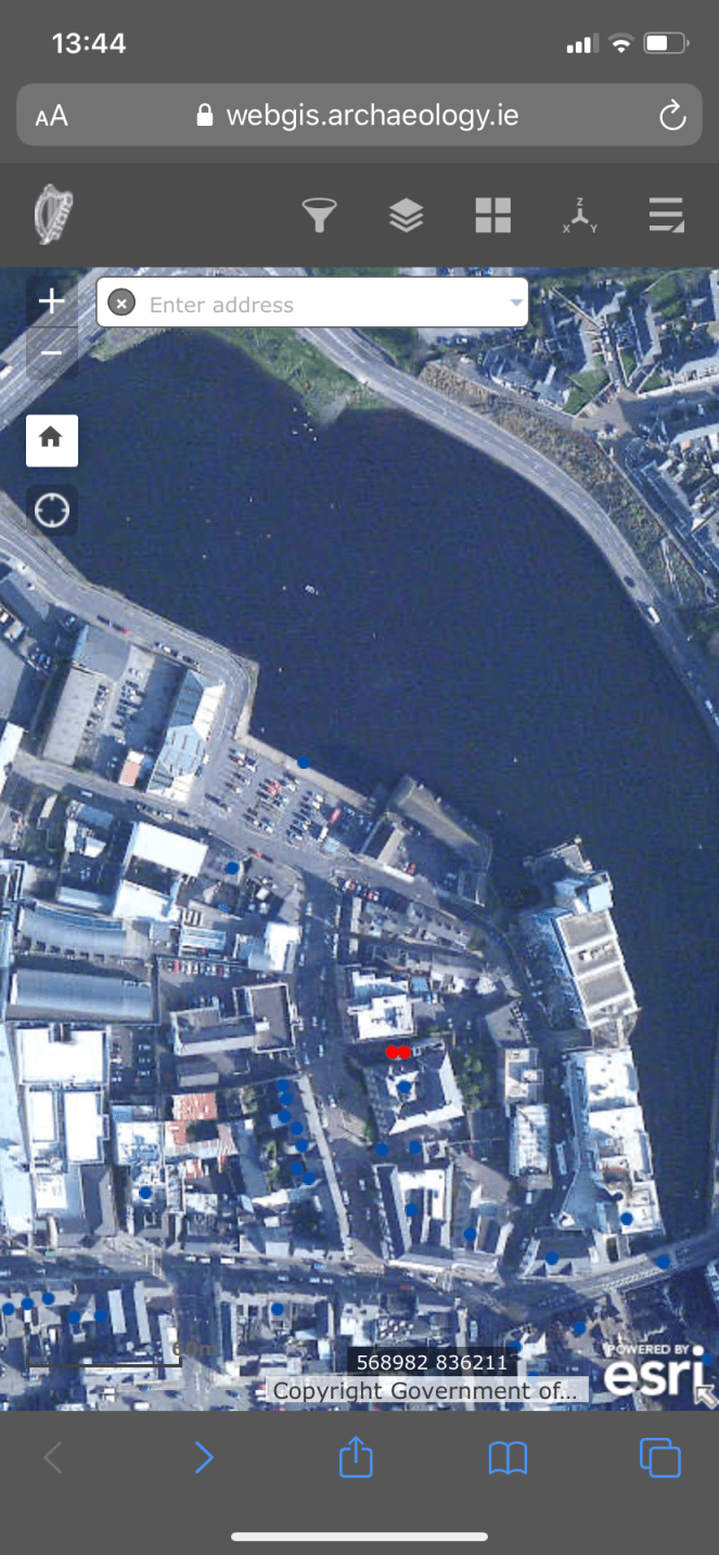
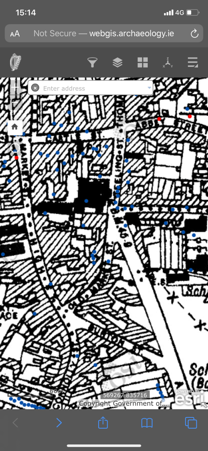
Below are a list of field notes, including date of visit and photographs. Maps (screen grab of the Town map, Historic 25 inch map, Cassini, modern OS and modern Aerial Photo) indicate the location of the BM, and photographs show the in situ BM or, if it has been removed, where it would have been located.
30th January 2020
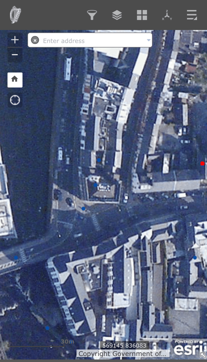
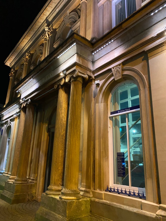
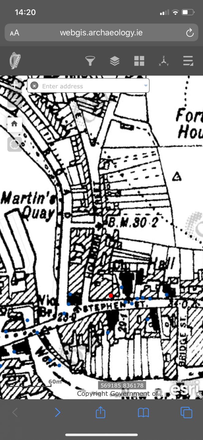
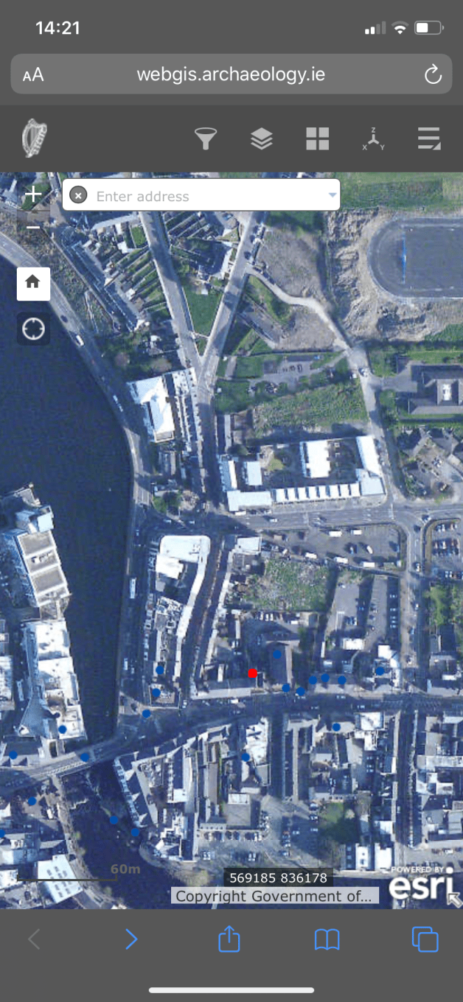
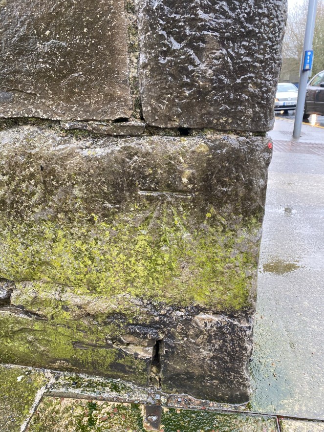
Ulster Bank, Stephen Street
The BM may have been found as one single horizontal carved line in the Scottish sandstone of the Ulster Bank (NIAH Reg. No. 32007154). It is no means certain and conflicts with the cartographic evidence. The horizontal line is on the second course of the SE corner of the eastern pillar base, facing E. the Historic 25 inch map shows that the BM faces S, on the S edge of the eastern pillar base. The BM also appears on the Cassini. This BM should be checked again examining the S edge.


Holborn Hill (Holborn Street)
BM was completely removed when Holborn Hill (marked on the Historic 25 inch map as Holborn Street), was joined by the new Connaughton Road. The BM was also marked in the Cassini. The BM would have been located on a N-S wall, facing West (wall associated with a Smithy to the east).


22nd February 2020
Lower New Street
BM not found (now destroyed?) located on SW corner of structure (stores?), facing SW. Structure may have been destroyed and replaced, or else renovated, as a modern house lies here. If renovated, BM may lie beneath modern mortar layer. Lower New Street named Lower Quay Lane on Historic 25 inch map. BM also marked on Cassini.


29th February 2020
Queen’s Stores
BM (destroyed) on NE corner of Queen’s Stores (Custom House Quay), is also present on the Cassini 6-inch map. Queen’s Stores are now destroyed and replaced by Queen’s Store Road.
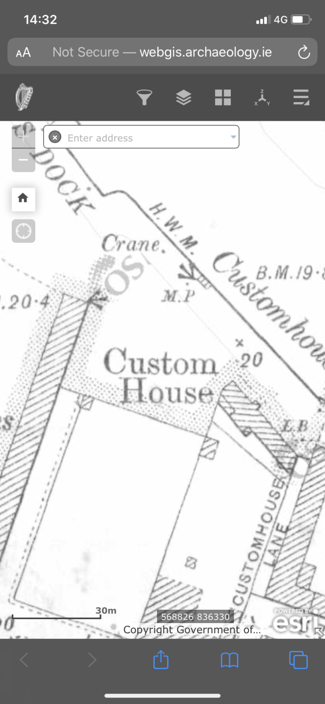
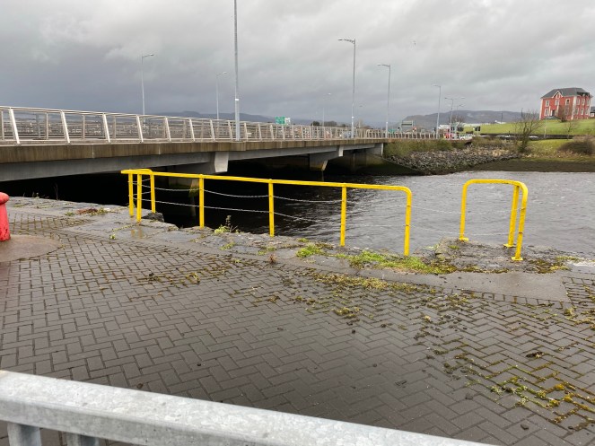
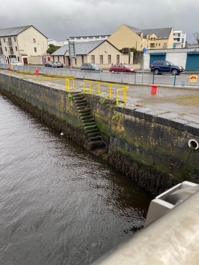
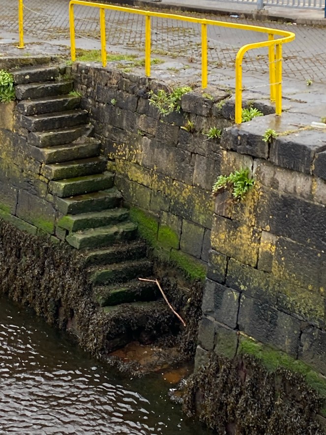
Custom House Quay
BM (not accessed yet) on SW corner of steps leading down to the water from Custom House Quay. Photographs looking SE from McHughs Bridge suggest that seaweed may obscure it, requires a careful site visit at low tide.

Union Street
BM (destroyed) on NE corner of (presumed) wall, also visible on the Cassini 6-inch. Now destroyed and replaced by car park (Plan4 Interior Design).


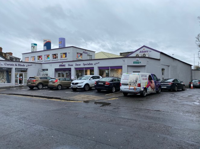
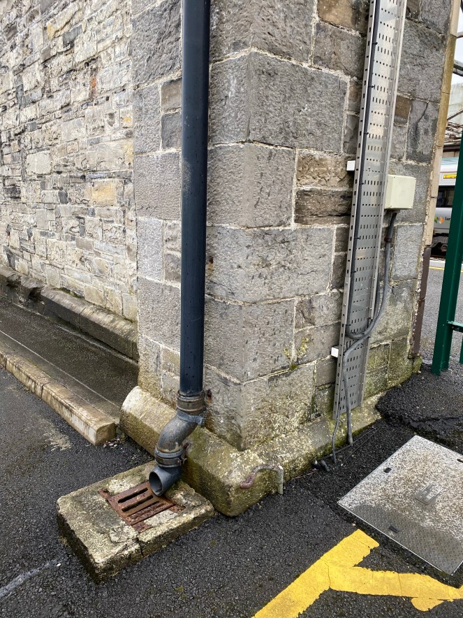
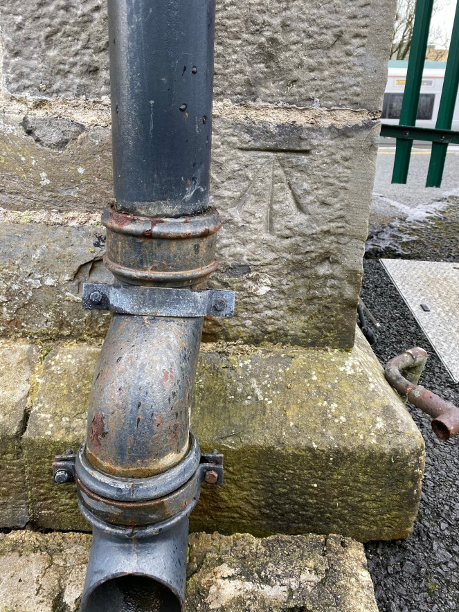
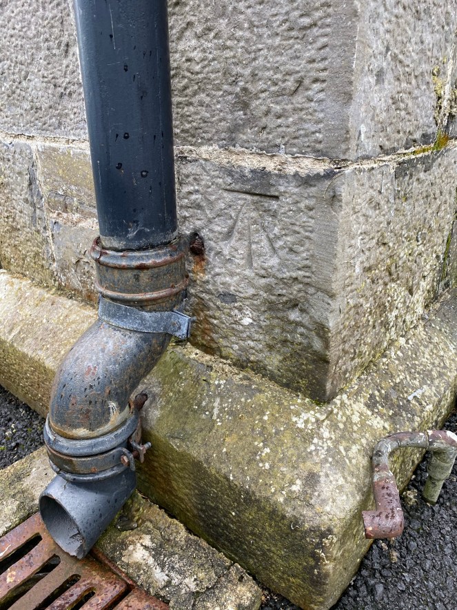
Mac Diarmada Station
There are 2 BMs on the railway station, one in the central steps and one on the NW corner. The BM on the steps is located on the western side of the main steps. The steps have been modified as part of a redesign of the entrance and the BM is nolonger visible, although it may be in situ. The second BM is still visible, located on the NW corner of the terminus next to a drainpipe.


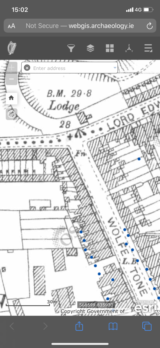
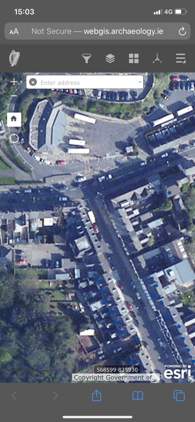
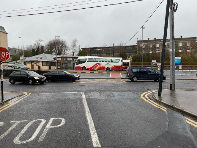
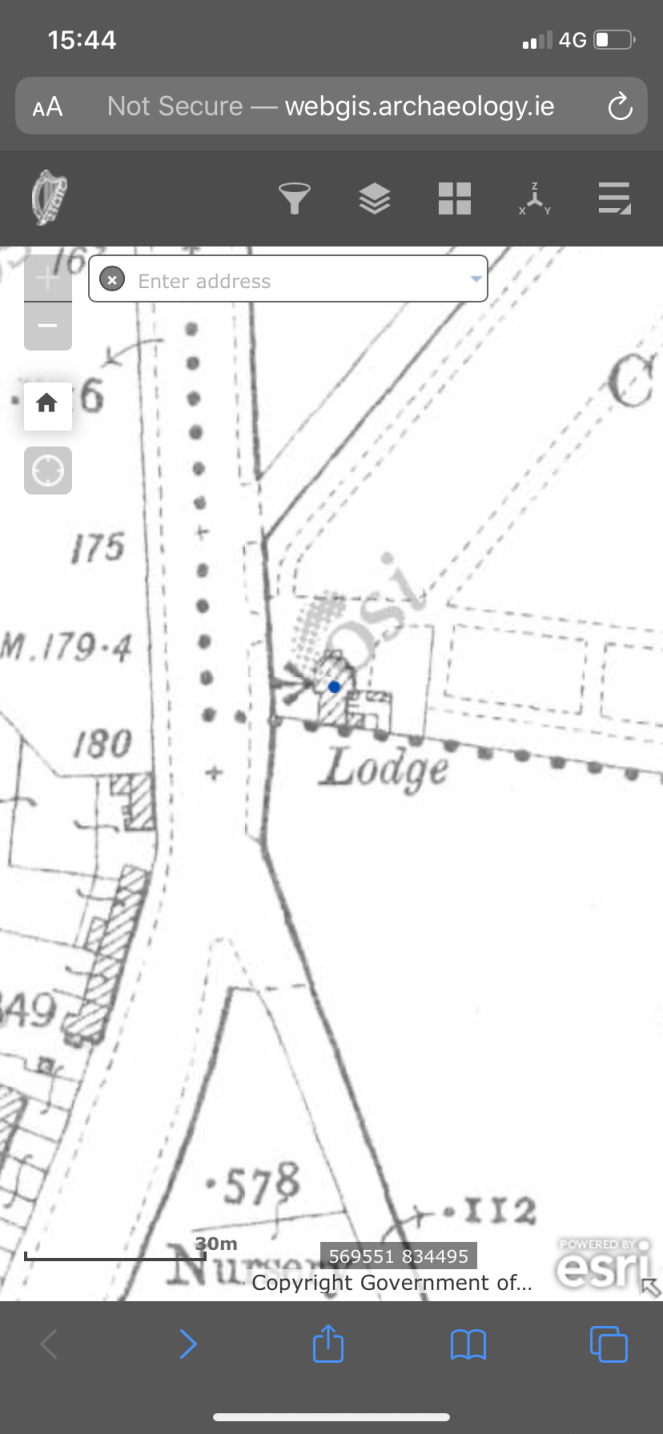
Lord Edward Street
BM (now destroyed) presumably on a wall just south of the Lodge, south of the railway station, facing Wolfe Tone Street and also visible on the Cassini 6-inch. Both the Lodge, wall and BM have been destroyed and the space is occupied by the Bus Station.
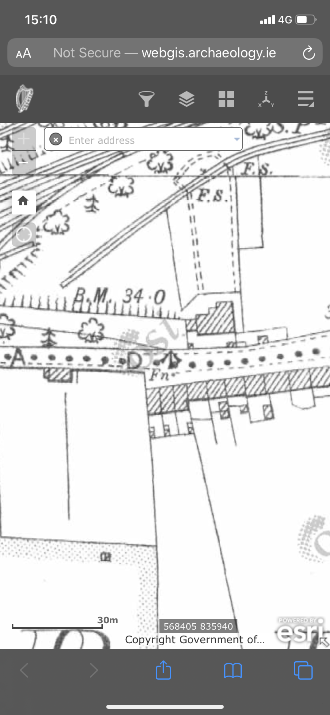
Knappagh Road
BM (destroyed) on north side of road, presumably on a wall, opposite a group of three terrace houses on the south side and visible on the Cassini 6-inch. Now removed, houses and an entrance are now present, enclosed by a modern concrete wall.

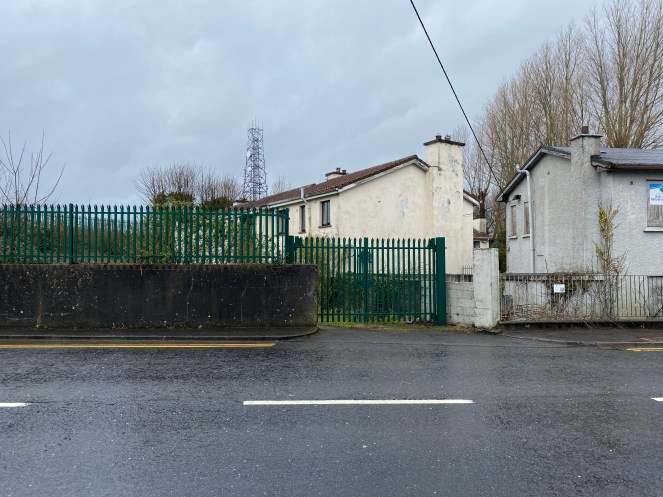

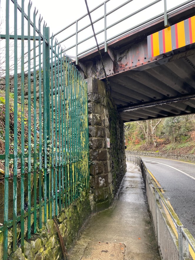
Knappagh Road Railway Bridge
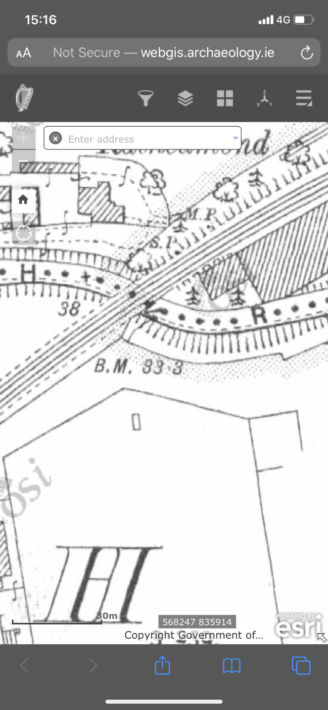
BM on the SE junction of Knappagh Road and the railway bridge that crosses it. Elevation on the 25 inch map of BM (33.3 feet) suggests it is on ground level rather than high near the bridge, however the Cassini 6 inch map records the elevation at 39.4 feet, a difference of 6 feet, strongly suggestions that the BM is elevated. It’s probable that the 25 inch map BM was replaced by the a second one, marked on the Cassini. There was no sign of the lower 25 inch map BM, which may have been removed during remodelling works. The Cassini 6 inch BM is out of reach, and is likely to be on the highest course of stonework – this needs to be checked – however it too may have been removed to accommodate the latest iteration of the bridge.


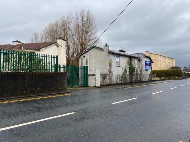
Thornhill, Knappagh Road
BM on south side of Knappagh Road, opposite Thornhill. Located presumably on a wall in front of the western house, in line with its western side, there is no sign of it now, presumably the wall was removed due to road widening. The BM does not appear on the Cassini 6-inch, but a Cassini BM does appear further west along Knappagh Road which is not present on the earlier Historic 25-inch. The western house, built c. 1790, is on the NIAH (Reg. No. 32006065).


Adelaide Street
On the NE corner of Adelaide Street and John Street the BM is present (and on the Cassini 6-inch) on a retaining wall. The adjacent building on the east side of the wall has been destroyed. BM located on the second course of stonework.


Lower John Street
BM is located on south wall, on the western edge of the east house, in a pair of terrace houses. It may survive in situ but appears to be covered by modern tiles or timber.


3rd March 2020
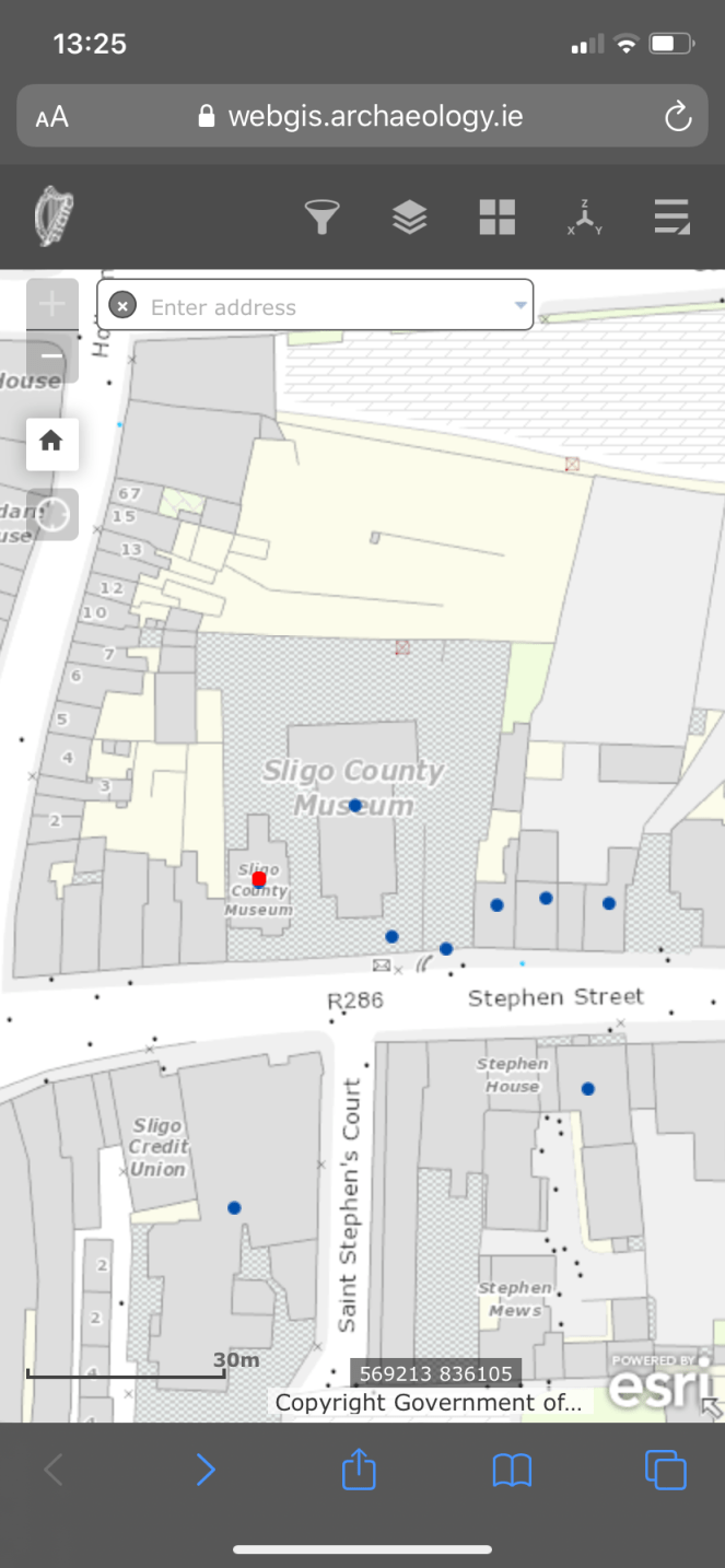
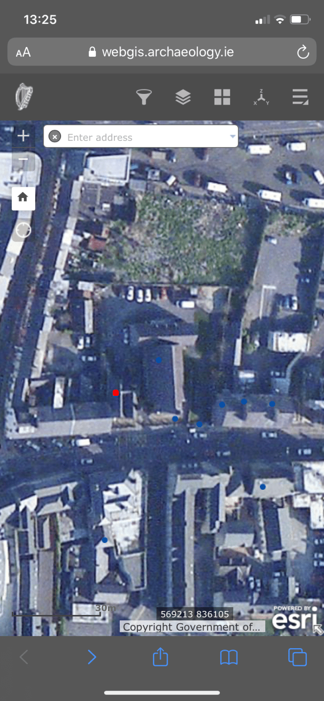
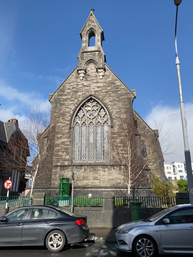
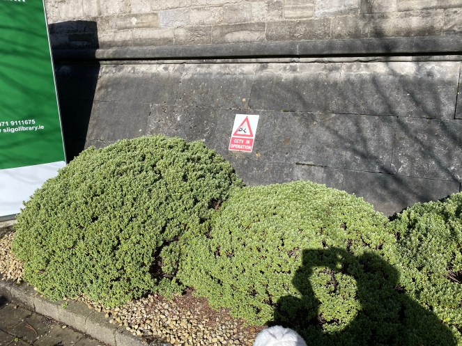
Sligo County Library, Stephen Street
BM located just off-centre on the south wall of library, facing south, on the first course (plinth), behind some shrubs, directly beneath a CCTV Warning sign. The library is former Methodist church built in 1851 (NIAH Reg. No. 32007151).


4th March 2020
Hazelwood Road (1)
BM marked on Historic 25inch, on north side of road, facing SW. Wall is covered in ivy and could not be seen. Quite possible that it is still in situ. BM is marked on the Cassini as well.


Hazelwood Road (2) (Beyond the U.D. Boundary)
BM marked on Historic 25inch, on north side of road, facing SSW. Wall is covered in ivy and could not be seen. Quite possible that it is still in situ. BM is marked on the Cassini as well.


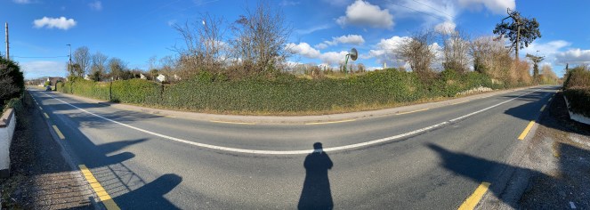
Hazelwood Road (3), Mile Stone (Beyond the U.D. Boundary)
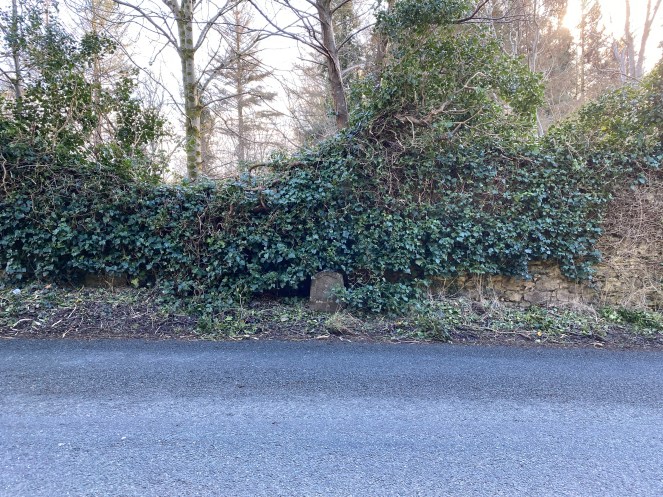
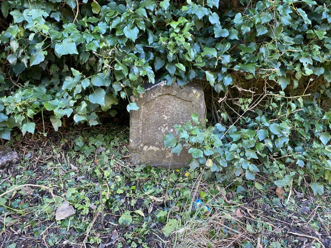
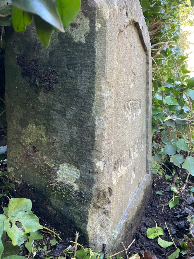
BM marked on Historic 25inch, facing NE, on south side of Hazelwood Road, at same location as the Sligo/Dromahair Mile Stone (MS). Despite exhaustive search of the wall, BM could not be seen. The MS has been defaced – the mileage and distances have been removed from the Stone carving. The NE corner of the MS, has also been carved out. It is suggested that the BM was located on the NE facing side of the MS, and that both have been defaced. BM & MS both appear on the Cassini. The Mile Stone itself is also very interesting, particularly as it has been defaced. A brief study of them in Wicklow suggests that Irish milestones are “mostly in the west and in Sligo in particular” (Jennings 2018).


18th March 2020
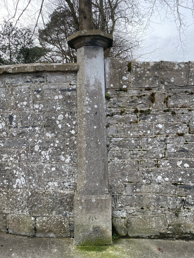
Marymount, Pearse Road
BM is at the base of a decorative pillar in the wall, north of the gated entrance to Marymount, south of a bench. Pearse Road is named as Albert Road on the Historic 25inch map.

Pearse Road / Cleveragh Road (West)
BM is destroyed. Visible on the Historic 25inch as located on west side of Albert Road (now Pearse Road), facing west opposite the Cleveragh Road junction. Cassini 6 inch (see entry below) suggests BM no longer exists at that location, but does appear on the east side of the road, slightly south.


Pearse Road / Cleveragh Road (East)
BM requires a visit. Not marked on the Historic 25 inch (another is located on west side of Albert Road (now Pearse Road), facing west opposite the Cleveragh Road junction, see above entry). Cassini 6 inch suggests that BM no longer exists at that location, but another BM does appear on the east side of the road. Needs a return visit to examine the Cassini location.

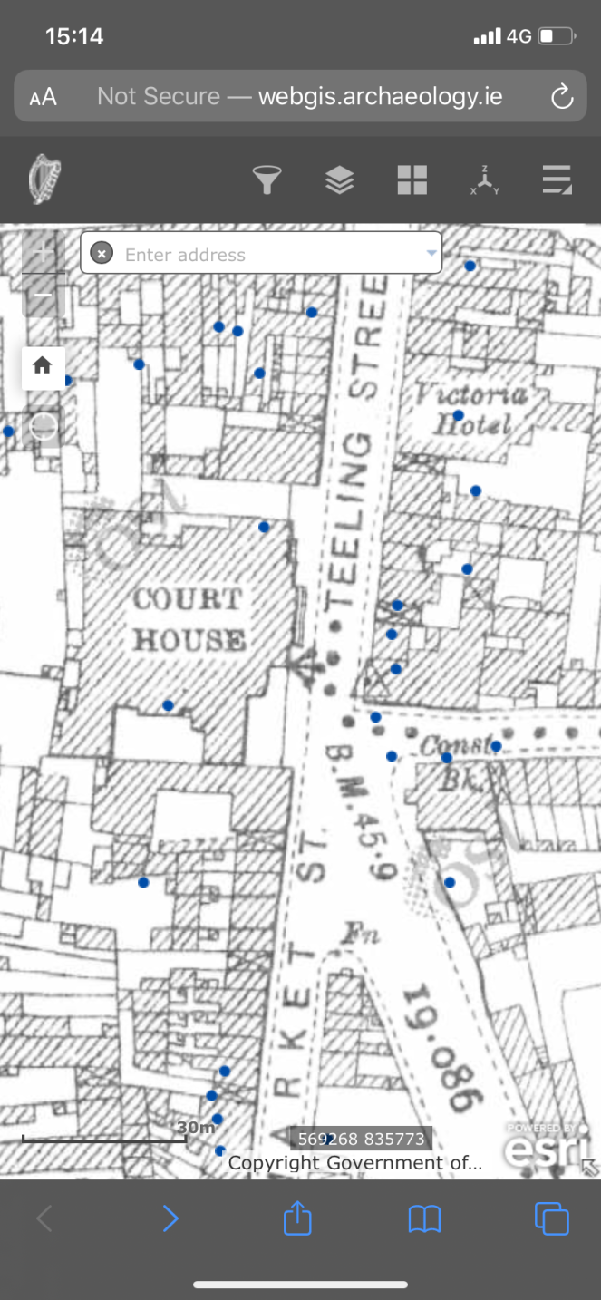
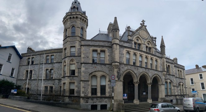
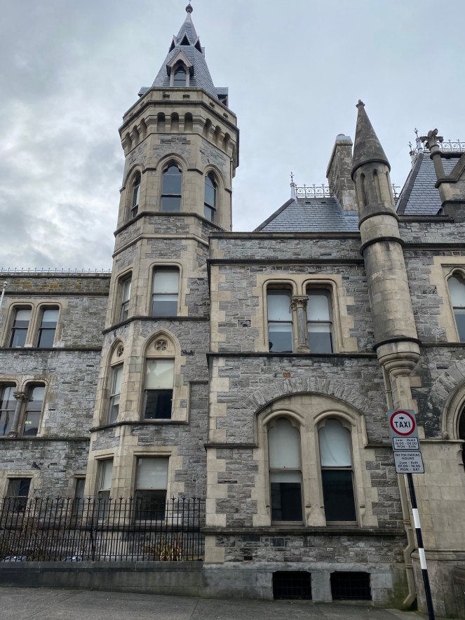
Sligo Court House, Teeling Street
BM located across second and third course of SE corner of Sligo Court House (NIAH Reg. No. 32012015).


Bridge Street (New Bridge)
A BM and a Trig Point are both located on the bridge (NIAH Reg. No. 32007110). The BM lies on the centre of the bridge, facing west. A mark was found, which differs in design from other BMs seen in Sligo. The horizontal ‘bench’ is missing and replaced by a single dot. Presumably this is due to the fact that the mark lies on top of the wall, rather than on the side of the wall, making the bench element redundant. The mark lies on the top course of the bridge wall.


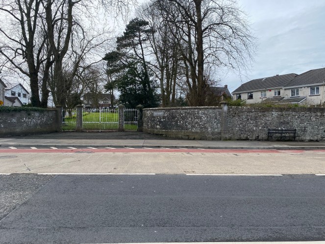
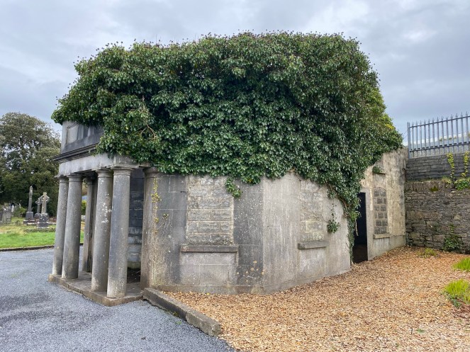
Lodge, Sligo Old Cemetery, Pearse Road
BM located on Ashlar Limestone on second course of western wall of the Gate Lodge (Reg. No. 32324002).


11 May 2020
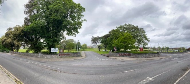
Gate Pillar, Laurel Hill, The Mall
BM on a Gate Pillar, at the entrance to Laurel Hill (Town map). The BM is present, relocated and rotated upside down, just peeking above the present day car park surface.

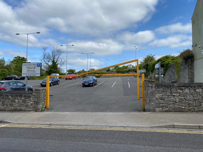
Laurel Hill
Laurel Hill was demolished and is now occupied by the Connaughton Road/The Mall car park.
23 May 2020
Gate Pillar, Lodge, Clayton Hotel Drive, Clarion Road
BM appears on the 1875 Sligo Town Map. It does not appear on subsequent maps. The BM, Gate Pillar and Lodge are all destroyed.
3 June 2020
District Lunatic Asylum (Clayton Hotel), Clarion Road
BM on the Town Map, located on the eastern side of the entrance portico of the Clayton Hotel.


4 June 2020
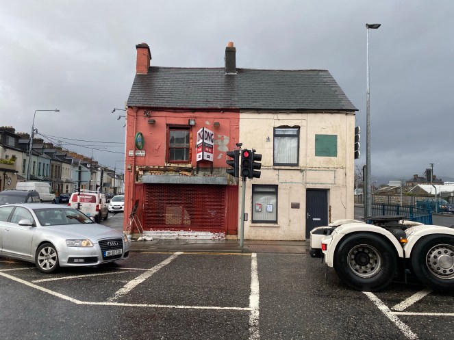
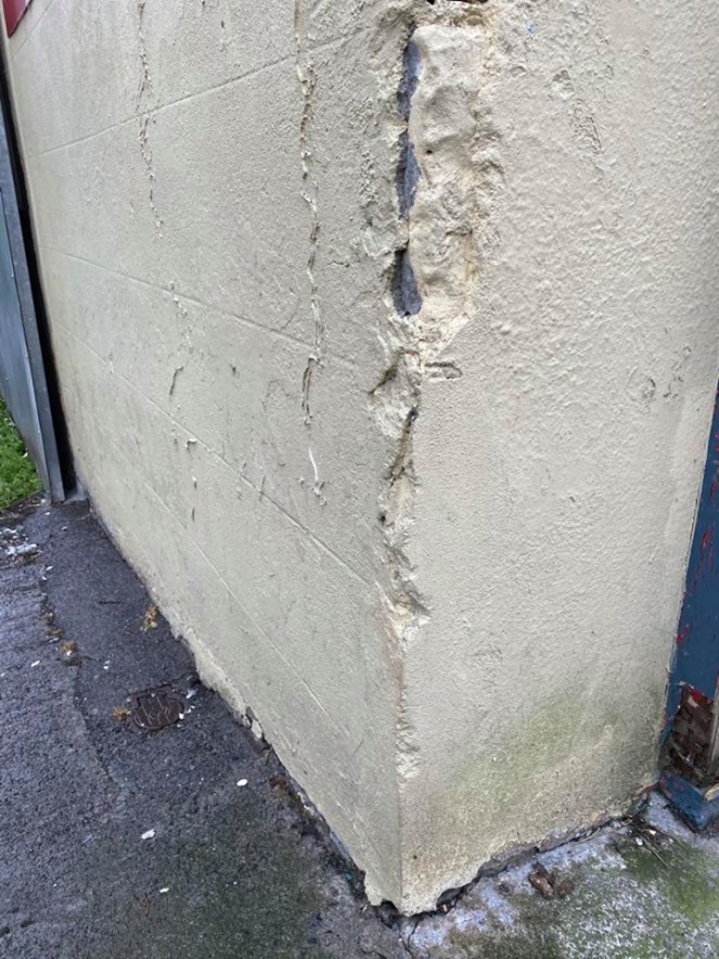
Building (currently occupied by Core Print), The Mall
BM appears on the 1875 Sligo Town Map. It does not appear on subsequent maps. The BM cannot be seen and if present is covered by a 1cm layer of concrete.
Further Reading:
Peattie, I. ‘First Primary Levelling, Ireland’, Benchmark Database. Accessed 03 April 2020. https://www.bench-marks.org.uk/survey12
Jennings, R. 2018. ‘A brief history of milestones’, by Cannon Robert Jennings, Our Wicklow Heritage. Accessed 04 April 2020. Page added by Student Heritage on 30/05/2018. http://www.countywicklowheritage.org/page/milestones_of_wicklow?path=0p4p
Chapter 5. Benchmarks. It’s Cork, Obviously. https://corkobviously.weebly.com/chapter-5—benchmarks.html
‘Guided by crows’ feet’ article in the Irish Times, Sat, Sep 13, 2008, 01:00 https://www.google.ie/amp/s/www.irishtimes.com/life-and-style/guided-by-crows-feet-1.938376
